| During
a solar eclipse the position of the moon is in between the sun and the earth.
Therefore, no sunlight - or less than usual - reaches the earth's surface in the
regions where the eclipse can be observed. Solar eclipses are rarely seen at any
given location on earth. Nevertheless the phenomenon can be observed somewhere
on the Earth’s surface twice, or in favourable occasions even five times
a year.
|
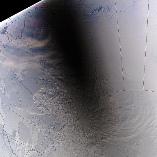
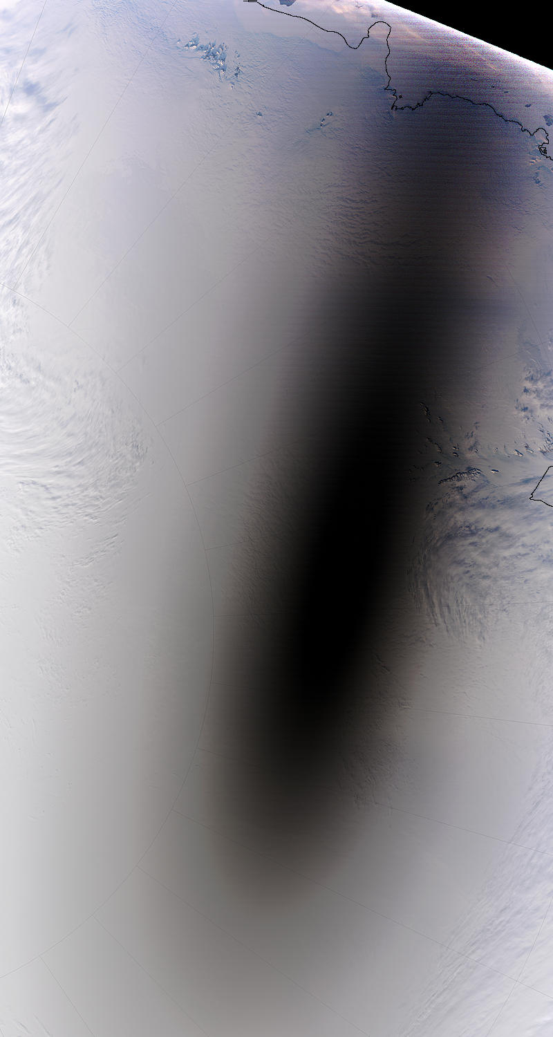
 Total eclipse over the Atlantic Ocean, February
26 1998.
Total eclipse over the Atlantic Ocean, February
26 1998.
Copyright © 1998 NASA/GOES. |
4. Partial
eclipse over North America, December 25 2000. Source: SeaWiFS Project, NASA/Goddard
Space Flight Center en ORBIMAGE.
|
| METEOSAT
Most
environmental satellites carry sensors that measure reflected sunlight. From these
measurements then satellite images are made that can be compared with the images
taken by a standard digital camera. The sensors are set up in a way to generate
an image of optimal quality given the available amount of sunlight. In areas where
the moon catches it's shadow, the amount of sunlight is different. This causes
a dark area on the 'standard' images in the visible channel.
The EUMETSAT
archives contain several examples of shadows of the moon on the earth's surface
during solar eclipses. The black-and-white animations show amongst others the
total solar eclipse of February 26 1998 over the Atlantic Ocean and of December
4 2002 over the southern part of the Indian Ocean. Other events shown are the
total eclipse of Augustus 11 1999 over Europe and June 21 2002 over the southern
Atlantic and Africa.
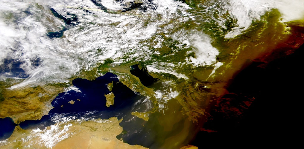
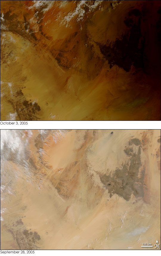
SeaWiFS
The total eclipse over
Europe in 1999 was also observed by the Sea-viewing wide Field-of view Sensor
(SeaWiFS) of the American
satellite Seastar (Orbview-2). The assumptions of the available amount of sunlight
that the computer software used to create the image, were not valid for Greece
and Turkey. For that reason the area where the solar eclipse could be observed
can easily be seen on the image (figure
3).
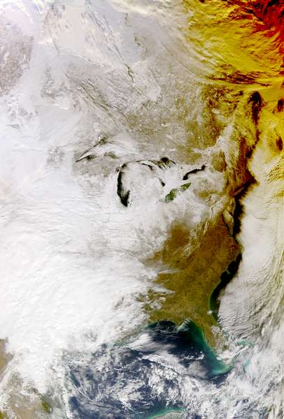
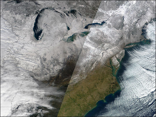
The image of the Grate Lakes in the United States and Canada of figure
4 also originates from SeaWiFS data. The images was made during the partial
eclipse of December 25 2000. Because the eclipse is only partial, the earth's
surface is not as dark as in the case of figure 3. However the yellow-brownish
shades and the mustard colour of Lake Erie (the far southeast one of the Great
Lakes) differ significantly from what is observed normally.
|


